

Wialon Multiple Map Options
Wialon’s multiple map options give fleet managers the flexibility to view tracked vehicles and assets on the map that best suits the task at hand. Depending on the maps enabled for the account, users can choose from multiple map providers and switch between street or road maps, satellite or aerial imagery, terrain-style maps, and hybrid views. This flexibility makes it easier to understand vehicle locations, review routes, monitor remote assets, and analyze fleet activity using the geographic context that is most useful for each situation.
Choose from Multiple Wialon Map Providers
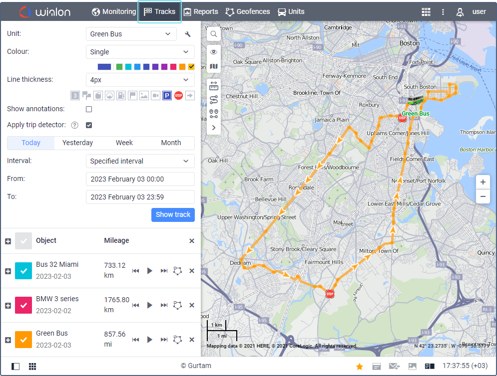
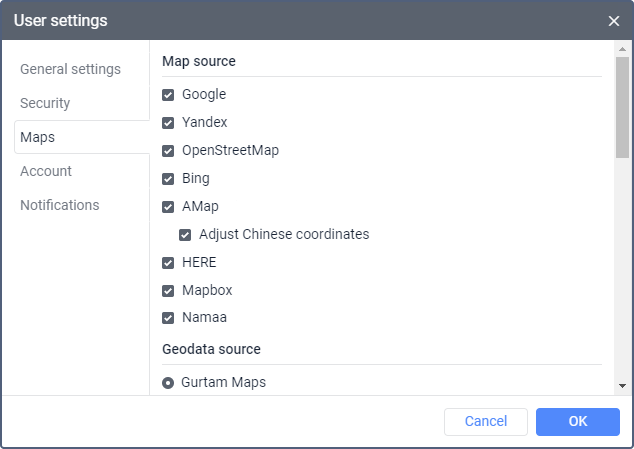
Wialon supports a variety of map providers, giving fleets more flexibility than relying on a single mapping source. Available options can include Gurtam Maps, OpenStreetMap, Bing, Google, HERE, Mapbox, and other regional or specialized services, depending on account configuration and provider availability. Because map coverage and detail can vary by location, having multiple options allows fleet managers to select a map that provides the clearest and most useful geographic information for their operating area.
View Fleet Activity from the Perspective You Need
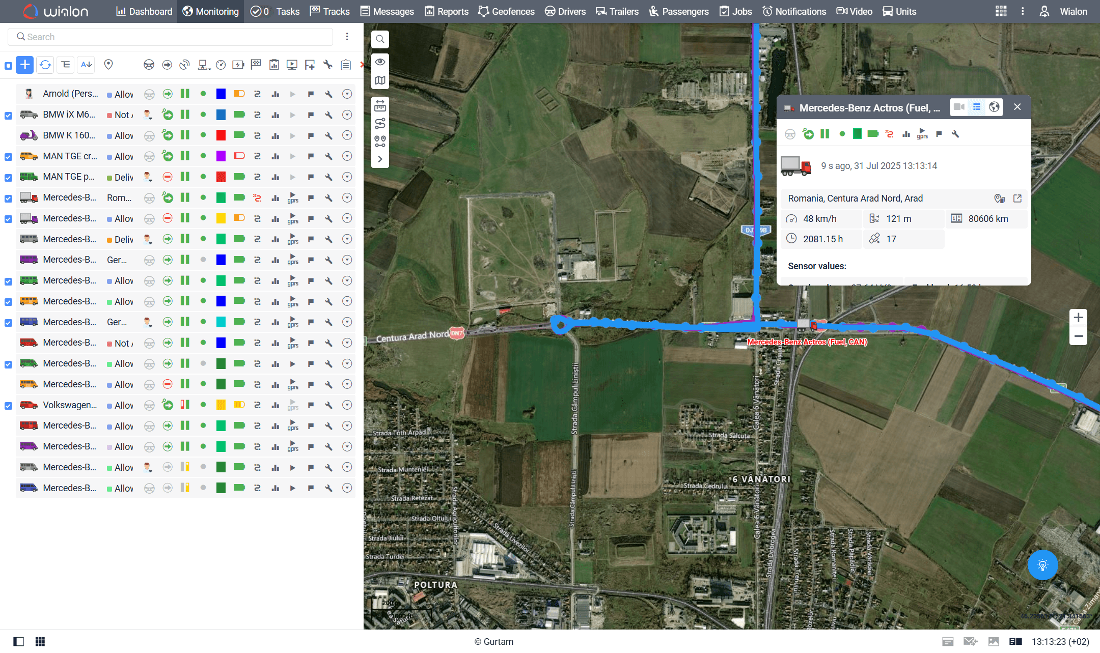
Different fleet management tasks benefit from different types of maps. Street and road views make it easier to understand road networks and vehicle routes, while satellite or aerial imagery provides visual context about buildings, properties, work sites, and surrounding land. Terrain or physical views can provide additional geographic context in areas where topography matters. With Wialon, users can switch between available basemaps to choose the perspective that best supports the task they are performing.
Make Fleet Locations Easier to Understand
GPS coordinates become more useful when they are displayed with the right geographic context. Wialon’s multiple map options can help fleet managers better understand where vehicles and assets are located, how routes relate to surrounding roads and properties, and where important fleet activity occurs. Users can select different basemaps while monitoring units, reviewing tracks, or working with geofences, helping turn location data into information that is easier to interpret and act on.

Get More from Wialon Mapping with Forall Tracking
Wialon’s multiple map options provide the flexibility to view fleet activity using the map source and visual perspective that best fit your operation. Whether you need clear street information for daily fleet monitoring, satellite imagery for remote assets and job sites, or another available mapping source for regional coverage, Wialon makes it easy to adapt the map to your needs. Forall Tracking can help you configure and use Wialon’s mapping capabilities as part of a practical GPS tracking solution for your fleet. Contact us today to learn more about Wialon and how its fleet management features can support your business.
Frequently Asked Questions
What are Multiple Map Options in Wialon?
Wialon’s multiple map options allow users to choose from different map providers and basemap types when monitoring vehicles and assets. Available options depend on the maps enabled for the Wialon account.
Which map providers does Wialon support?
Wialon can support map sources such as Gurtam Maps, OpenStreetMap, Google, Bing, HERE, and Mapbox. The exact providers available depend on account configuration and provider availability.
Can Wialon display satellite maps?
Yes. When a supported satellite or aerial basemap is enabled, users can view tracked vehicles and assets using satellite or aerial imagery for additional visual context.
Can users switch between street and satellite views in Wialon?
Yes. Users can switch between available basemaps from the Wialon map interface, making it possible to select a street, satellite, terrain, hybrid, or other supported view depending on the task.
Why are multiple map providers useful for fleet tracking?
Different map providers can offer different levels of road detail, imagery, geographic coverage, and regional information. Multiple options allow fleet managers to choose the map source that works best for their operating area.
How can satellite maps help fleet managers?
Satellite or aerial imagery can help managers understand the surroundings of a vehicle or asset, including buildings, properties, job sites, parking areas, and remote locations that may not be as visually clear on a standard road map.
What is the benefit of terrain maps in Wialon?
Terrain or physical maps can provide additional information about the geography and topography of an area. This can be particularly useful when monitoring vehicles or assets operating in rural, remote, or geographically varied locations.
Can different Wialon maps be used when reviewing vehicle history?
Yes. Available basemaps can provide useful geographic context when users review vehicle tracks and historical location information, helping them better understand where recorded fleet activity occurred.
Can Wialon map options help when working with geofences?
Yes. Selecting an appropriate map view can make it easier to understand locations and surrounding geography when viewing or working with geofences, particularly around properties, customer locations, worksites, and other important areas.
Are all Wialon map providers available to every user?
Not necessarily. Available map providers and basemap types depend on the Wialon account configuration, enabled map sources, regional availability, and requirements of third-party map services. Some third-party maps may require additional configuration or API keys.

Check Pricing
All of our GPS tracking solutions are customized for your business and tailored to your budget...

Return on Investment
At GPS Tracking Canada, we understand that every company benefits from GPS Tracking in different ways...

Request a Demo
Get a live one-on-one demonstration from GPS Tracking Canada. See for yourself how customized...
For more information, or to schedule a demo or an installation,